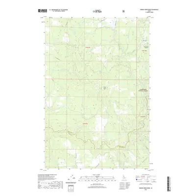
2020 Map of Brown Creek Ridge
USGS Topo · Published 2020About this map
Brown Creek Ridge dominates this drainage basin within the Clearwater National Forest, where a complex network of creeks defines the Idaho landscape. The map reveals a region heavily shaped by water and elevation, notably at Musselshell Meadows and along the winding course of Lolo Creek. Local transit is guided by the rugged topography, utilizing corridors such as Lacy Meadows Rd and the aptly named School House Rd, which hints at the area's rural infrastructure.
Find a feature on this map
37 named features on this map. Tap any name to fly to it.
Don’t see what you’re looking for? This feature index may not catch every label — zoom into the map to look around manually.
Map Details
Editions of this 2020 Brown Creek Ridge Map
This is the sole edition of this map. No revisions or reprints were ever made.
Other maps of this area

1924 · Weippe
USGS Topo · 1:125,000

1956 · Hamilton
USGS Topo · 1:250,000

1959 · Hamilton
USGS Topo · 1:250,000

1960 · Hamilton
USGS Topo · 1:250,000

1964 · Hamilton
USGS Topo · 1:250,000

1966 · Kooskia
USGS Topo · 1:24,000

1966 · Pierce
USGS Topo · 1:24,000
1966 · Glenwood
USGS Topo · 1:24,000
1966 · Hemlock Butte
USGS Topo · 1:24,000
1966 · Brown Creek Ridge
USGS Topo · 1:24,000