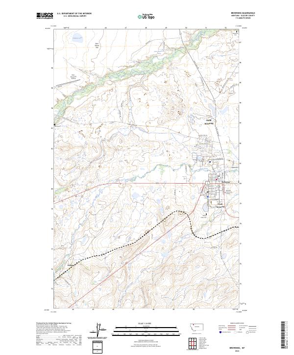
2024 Map of Browning
USGS Topo · Published 2024About this map
Browning serves as a central hub on the Blackfeet Indian Reservation, where the modern landscape is defined by the confluence of Willow Creek and Flatiron Creek. The town is segmented into North Browning, South Browning, and the main central district, which houses the Blackfeet Community College. This area shows a transition from the established street grids of the town center, including 1st Ave NW and SW Boundary St, to the more dispersed residential patterns along Blevins Tract.
Find a feature on this map
53 named features on this map. Tap any name to fly to it.
Don’t see what you’re looking for? This feature index may not catch every label — zoom into the map to look around manually.
Map Details
Editions of this 2024 Browning Map
This is the sole edition of this map. No revisions or reprints were ever made.
Other maps of this area

1901 · Browning
USGS Topo · 1:125,000

1903 · Browning
USGS Topo · 1:125,000

1911 · Blackfoot
USGS Topo · 1:125,000

1913 · Marias Pass
USGS Topo · 1:125,000

1914 · Heart Butte
USGS Topo · 1:125,000

1918 · Heart Butte
USGS Topo · 1:125,000

1960 · Cut Bank
USGS Topo · 1:250,000

1963 · Cut Bank
USGS Topo · 1:250,000

1964 · Cut Bank
USGS Topo · 1:250,000

1968 · Browning NE
USGS Topo · 1:24,000