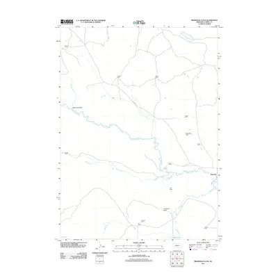
2011 Map of Brownlee Flats
USGS Topo · Published 2011About this map
The North Loup River meanders across the Sandhills of Cherry County, defining a landscape dominated by extensive cattle ranching operations and broad alluvial plains. This 2011 survey documents the persistent settlement pattern of the region, where family-named properties like the Shadbolt Ranch and Box T Ranch anchor the rural geography. The small community of Brownlee serves as the primary hub, situated near the intersection of Seneca Rd and Brownlee Rd.
Find a feature on this map
22 named features on this map. Tap any name to fly to it.
Don’t see what you’re looking for? This feature index may not catch every label — zoom into the map to look around manually.
Map Details
Editions of this 2011 Brownlee Flats Map
This is the sole edition of this map. No revisions or reprints were ever made.
Other maps of this area

1948 · Seneca
USGS Topo · 1:62,500

1948 · Seneca 4
USGS Topo · 1:62,500

1949 · Seneca 4
USGS Topo · 1:62,500

1951 · Seneca
USGS Topo · 1:62,500

1951 · Bull Lake
USGS Topo · 1:62,500

1951 · Brownlee
USGS Topo · 1:62,500

1957 · Valentine
USGS Topo · 1:250,000

1959 · Valentine
USGS Topo · 1:250,000

1985 · Goose Creek
USGS Topo · 1:100,000
1985 · Brownlee
USGS Topo · 1:24,000