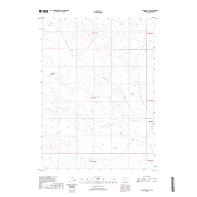
2017 Map of Brownlee Flats
USGS Topo · Published 2017About this map
Brownlee anchors this 2017 survey of the Nebraska Sandhills in Cherry County, where the settlement sits at a bend in the North Loup River. The landscape is defined by its wide alluvial basins and valley systems, including Lee Flats and the broad Brownlee Flats to the north. These features reflect the unique hydrology of the region, where the high water table of the Ogallala Aquifer feeds numerous surface features. Waterways such as Wamaduze Cr and Brush Cr drain into the river, while Horseshoe Lake occupies a low-lying pocket within Horseshoe Valley. Transportation in this part of the county relies on a sparse network of section-line routes like Seneca Rd and Brownlee Rd, which connect the isolated ranching community to the surrounding prairie.
Find a feature on this map
18 named features on this map. Tap any name to fly to it.
Don’t see what you’re looking for? This feature index may not catch every label — zoom into the map to look around manually.
Map Details
Editions of this 2017 Brownlee Flats Map
This is the sole edition of this map. No revisions or reprints were ever made.
Other maps of this area

1948 · Seneca
USGS Topo · 1:62,500

1948 · Seneca 4
USGS Topo · 1:62,500

1949 · Seneca 4
USGS Topo · 1:62,500

1951 · Seneca
USGS Topo · 1:62,500

1951 · Bull Lake
USGS Topo · 1:62,500

1951 · Brownlee
USGS Topo · 1:62,500

1957 · Valentine
USGS Topo · 1:250,000

1959 · Valentine
USGS Topo · 1:250,000

1985 · Goose Creek
USGS Topo · 1:100,000
1985 · Brownlee
USGS Topo · 1:24,000