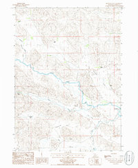
1985 Map of Brownlee Flats
USGS Topo · Published 1986About this map
The North Loup River meanders across this mid-1980s landscape in Cherry County, carving a path between the elevated plateaus of Brownlee Flats and Lee Flats. This section of Nebraska's Sandhills is characterized by its ranching heritage, with several prominent family operations including D Hanna Ranch, Pound Ranch, and C Reiser Ranch distributed across the valley floors. The small settlement of Brownlee serves as the focal point for this rural community near the eastern edge of the quadrangle.
Find a feature on this map
20 named features on this map. Tap any name to fly to it.
Don’t see what you’re looking for? This feature index may not catch every label — zoom into the map to look around manually.
Map Details
Editions of this 1985 Brownlee Flats Map
This is the sole edition of this map. No revisions or reprints were ever made.
Other maps of this area

1948 · Seneca
USGS Topo · 1:62,500

1948 · Seneca 4
USGS Topo · 1:62,500

1949 · Seneca 4
USGS Topo · 1:62,500

1951 · Seneca
USGS Topo · 1:62,500

1951 · Bull Lake
USGS Topo · 1:62,500

1951 · Brownlee
USGS Topo · 1:62,500

1957 · Valentine
USGS Topo · 1:250,000

1959 · Valentine
USGS Topo · 1:250,000

1985 · Goose Creek
USGS Topo · 1:100,000
1985 · Brownlee
USGS Topo · 1:24,000