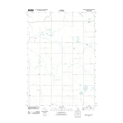
2011 Map of Browns Corners
USGS Topo · Published 2011About this map
North Branch Tobacco River and its companion, the Middle Branch Tobacco River, carve through the glacial landscape of Sheridan Township in this 2011 survey. The region is defined by its abundance of small water bodies, ranging from the northern Drachenburg Lake and Howland Lake to the southern Bailey Lake and Round Lake. The settlement pattern follows a distinct grid of country roads, with small nodes at Browns Corners and Dover. For family historians, the area is well-marked by several burial grounds, including Saint John's Lutheran Cemetery, Ott Cemetery, and Thompson Cemetery. The presence of the River Valley RV Park near the river's path suggests the transition of this area into a recreational destination, while many of the lake names like Lily Lake, Bass Lake, and Upper Brennan Lake point to the area's natural character.
Find a feature on this map
53 named features on this map. Tap any name to fly to it.
Don’t see what you’re looking for? This feature index may not catch every label — zoom into the map to look around manually.
Map Details
Editions of this 2011 Browns Corners Map
This is the sole edition of this map. No revisions or reprints were ever made.
Other maps of this area

1954 · Traverse City
USGS Topo · 1:250,000

1954 · Midland
USGS Topo · 1:250,000

1957 · Harrison
USGS Topo · 1:62,500

1958 · Traverse City
USGS Topo · 1:250,000

1958 · Midland
USGS Topo · 1:250,000

1959 · Midland
USGS Topo · 1:250,000

1959 · Clare
USGS Topo · 1:62,500

1966 · Midland
USGS Topo · 1:250,000

1969 · Meredith SW
USGS Topo · 1:24,000

1969 · Coleman
USGS Topo · 1:24,000