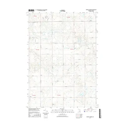
2017 Map of Browns Corners
USGS Topo · Published 2017About this map
Browns Corners and the small settlement of Dover anchor this rural landscape in Michigan's Clare County, where the topography is defined by the winding paths of the Middle Branch Tobacco River and the North Branch Tobacco River. The area is densely pocketed with small lakes and kettle-like basins, including Bailey Lake, Round Lake, and the clustered Brennan Lakes. Local genealogy is well-preserved through several small burial grounds scattered across the townships, such as Saint John's Lutheran Cemetery in the northeast and Wood Cemetery near the western edge. The drainage patterns of Spike Horn Creek and Wickham Creek illustrate the glacial heritage of this region, providing a detailed view of the terrain before modern development altered these natural hydrology networks.
Find a feature on this map
63 named features on this map. Tap any name to fly to it.
Don’t see what you’re looking for? This feature index may not catch every label — zoom into the map to look around manually.
Map Details
Editions of this 2017 Browns Corners Map
This is the sole edition of this map. No revisions or reprints were ever made.
Other maps of this area

1954 · Traverse City
USGS Topo · 1:250,000

1954 · Midland
USGS Topo · 1:250,000

1957 · Harrison
USGS Topo · 1:62,500

1958 · Traverse City
USGS Topo · 1:250,000

1958 · Midland
USGS Topo · 1:250,000

1959 · Midland
USGS Topo · 1:250,000

1959 · Clare
USGS Topo · 1:62,500

1966 · Midland
USGS Topo · 1:250,000

1969 · Meredith SW
USGS Topo · 1:24,000

1969 · Coleman
USGS Topo · 1:24,000