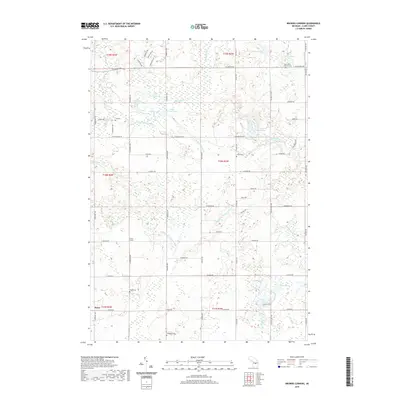
2019 Map of Browns Corners
USGS Topo · Published 2019About this map
Browns Corners and Dover anchor this rural landscape in Sheridan Township, where a dense network of country roads connects scattered farmsteads and small cemeteries. The area is defined by its complex hydrology, with the Middle Br Tobacco River and N Br Tobacco River winding through terrain dotted with numerous glacial lakes. Genealogists will find significant local value in the distribution of community burial grounds, including Saint John's Lutheran Cem in the northeast and others like Ott Cem, Arthur Cem, and Thompson Cem distributed across the township. The northern reaches feature a cluster of water bodies such as Norway Lake, Bass Lake, and Upper Brennan Lake, illustrating the post-glacial character of the Clare County interior. Further south, Bailey Lake and Round Lake sit near the headwaters of Bailey Cr, highlighting a landscape that remains primarily defined by its natural water features and local rural intersections.
Find a feature on this map
62 named features on this map. Tap any name to fly to it.
Don’t see what you’re looking for? This feature index may not catch every label — zoom into the map to look around manually.
Map Details
Editions of this 2019 Browns Corners Map
This is the sole edition of this map. No revisions or reprints were ever made.
Other maps of this area

1954 · Traverse City
USGS Topo · 1:250,000

1954 · Midland
USGS Topo · 1:250,000

1957 · Harrison
USGS Topo · 1:62,500

1958 · Traverse City
USGS Topo · 1:250,000

1958 · Midland
USGS Topo · 1:250,000

1959 · Midland
USGS Topo · 1:250,000

1959 · Clare
USGS Topo · 1:62,500

1966 · Midland
USGS Topo · 1:250,000

1969 · Meredith SW
USGS Topo · 1:24,000

1969 · Coleman
USGS Topo · 1:24,000