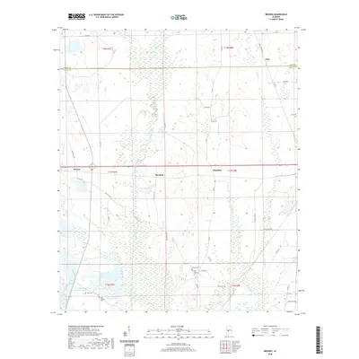
2020 Map of Browns
USGS Topo · Published 2020About this map
Bogue Chitto Cr defines the landscape of this central Alabama region as it flows south toward the Dallas and Perry County line. The settlement patterns at Browns, Marshall, and Massillon are oriented along the primary transportation corridor, illustrating the rural character of the area in recent years. This 2020 map identifies several sites essential for genealogical research, including the Vernon Cem, New Vernon Cem, and Saint Chapter Cem. The terrain is punctuated by significant water bodies like Lake Walnutta and Big B Ranch Lake, while the southern portion of the quadrangle features the Weissinger Lakes system, including W W Weissinger Number 2 Lake. The intricate network of county roads, such as Bates Station Rd and Dallas Co 180, connects these small communities and isolated landmarks across the basin of Chaney Cr.
Find a feature on this map
56 named features on this map. Tap any name to fly to it.
Don’t see what you’re looking for? This feature index may not catch every label — zoom into the map to look around manually.
Map Details
Editions of this 2020 Browns Map
This is the sole edition of this map. No revisions or reprints were ever made.
Other maps of this area

1953 · Montgomery
USGS Topo · 1:250,000

1956 · Montgomery
USGS Topo · 1:250,000

1957 · Montgomery
USGS Topo · 1:250,000

1958 · Selma
USGS Topo · 1:62,500

1959 · Summerfield
USGS Topo · 1:62,500

1968 · Uniontown East
USGS Topo · 1:24,000

1968 · Browns
USGS Topo · 1:24,000

1968 · Safford
USGS Topo · 1:24,000

1968 · Central Mills
USGS Topo · 1:24,000

1975 · Selma NW
USGS Topo · 1:24,000