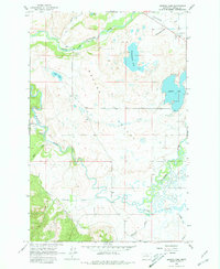
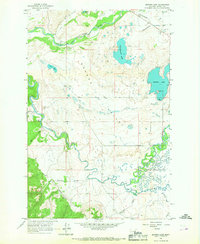
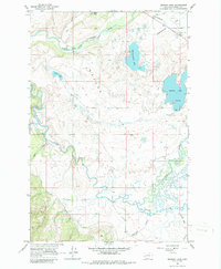
1965 Map of Browns Lake
USGS Topo · Published 1981About this map
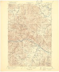
The Blackfoot River and its North Fork dominate this mid-century landscape in Powell County, following a winding course through the Nevada Valley. The 1961 aerial photography and 1965 field checking record a region defined by its water and agricultural infrastructure, including the Kleinschmidt Flat and the prominent Browns Lake with its lakeshore Campground. The map details the rural character of the area through features like the Raymond Bridge crossing and the confluence of several tributaries, including Wales Creek, Nevada Creek, and McElwain Creek. Small settlements and named locations such as Yourname and Frazier appear alongside resource extraction sites like the Gravel Pits near Kleinschmidt Lake, providing a clear view of the valley's mid-1960s land use and local geography.
Find a feature on this map
17 named features on this map. Tap any name to fly to it.
Don’t see what you’re looking for? This feature index may not catch every label — zoom into the map to look around manually.
Map Details
Editions of this 1965 Browns Lake Map
3 editions found
Other maps of this area

1889 · Helena
USGS Topo · 1:250,000

1893 · Helena
USGS Topo · 1:250,000

1899 · Helena
USGS Topo · 1:250,000

1902 · Ovando
USGS Topo · 1:125,000

1903 · Coopers Lake
USGS Topo · 1:125,000

1903 · Helena
USGS Topo · 1:250,000

1905 · Ovando
USGS Topo · 1:125,000
1919 · Drummond
USGS Topo · 1:125,000
1921 · Drummond
USGS Topo · 1:125,000

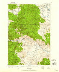
1947 · Butte
USGS Topo · 1:250,000