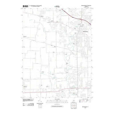
2010 Map of Brownsburg
USGS Topo · Published 2010About this map
Brownsburg and the surrounding townships are depicted here in detail during a period of significant suburban growth. The landscape is defined by the winding course of White Lick Creek and its many tributaries, including West Fork White Lick Creek and Abner Creek. For genealogists and local historians, this survey is particularly valuable for its mapping of numerous small burial grounds that dot the area, such as McDaniels Cemetery, Lingeman Cemetery, and Saint Malachy West Cemetery. While modern developments like the Hendricks County Golf Course and residential subdivisions are prominent, the underlying road network still follows historic rural routes like E Co RD 800 N and E Wall Street Pike. Several small impoundments, including Donahue Lake and Jeto Lake, highlight how the regional hydrology was managed to support new communities near Pittsboro and Avon.
Find a feature on this map
60 named features on this map. Tap any name to fly to it.
Don’t see what you’re looking for? This feature index may not catch every label — zoom into the map to look around manually.
Map Details
Editions of this 2010 Brownsburg Map
This is the sole edition of this map. No revisions or reprints were ever made.
Other maps of this area

1953 · Bridgeport
USGS Topo · 1:24,000

1953 · Clayton
USGS Topo · 1:24,000

1953 · Fayette
USGS Topo · 1:24,000

1953 · Lizton
USGS Topo · 1:24,000

1953 · Danville
USGS Topo · 1:24,000

1953 · Brownsburg
USGS Topo · 1:24,000

1953 · Zionsville
USGS Topo · 1:24,000

1953 · Plainfield
USGS Topo · 1:24,000

1953 · Clermont
USGS Topo · 1:24,000

1953 · Indianapolis
USGS Topo · 1:250,000