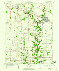
1959 Map of Brownsburg
USGS Topo · Published 1960About this map
Brownsburg serves as the primary hub of this eastern Hendricks County landscape, where the New York Central and Baltimore and Ohio railroads converge amid a network of small agricultural settlements and rural institutions. The mid-century character of the area is defined by its transit corridors, including the Memorial Highway near Avon and the emerging Brownsburg Airfield to the east. Water drainage is dominated by the winding path of White Lick Creek and its West Fork, which carve through the townships of Brown, Lincoln, and Washington.
Find a feature on this map
40 named features on this map. Tap any name to fly to it.
Don’t see what you’re looking for? This feature index may not catch every label — zoom into the map to look around manually.
Map Details
Editions of this 1959 Brownsburg Map
This is the sole edition of this map. No revisions or reprints were ever made.
Other maps of this area

1953 · Bridgeport
USGS Topo · 1:24,000

1953 · Clayton
USGS Topo · 1:24,000

1953 · Fayette
USGS Topo · 1:24,000

1953 · Lizton
USGS Topo · 1:24,000

1953 · Danville
USGS Topo · 1:24,000

1953 · Brownsburg
USGS Topo · 1:24,000

1953 · Zionsville
USGS Topo · 1:24,000

1953 · Plainfield
USGS Topo · 1:24,000

1953 · Clermont
USGS Topo · 1:24,000

1953 · Indianapolis
USGS Topo · 1:250,000