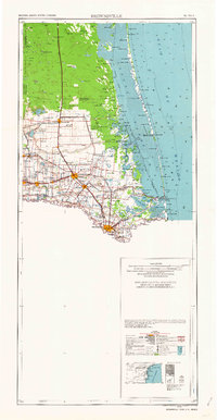
1962 Map of Brownsville
USGS Topo · Published 1962About this map
The Rio Grande Delta in the early 1960s serves as a busy corridor of international transit and coastal industry. This survey illustrates the intricate landscape of the Lower Rio Grande Valley, where the Rio Grande marks the border between Texas and Mexico. Near the coast, the Laguna Atascosa National Wildlife Refuge preserves the shoreline of Laguna Madre, while offshore, Padre Island and Boca Chica Island shield the mainland from the Gulf of Mexico.
Find a feature on this map
96 named features on this map. Tap any name to fly to it.
Don’t see what you’re looking for? This feature index may not catch every label — zoom into the map to look around manually.
Map Details
Editions of this 1962 Brownsville Map
This is the sole edition of this map. No revisions or reprints were ever made.
Other maps of this area

1914 · San Juan
USGS Topo · 1:48,000

1916 · San Juan
USGS Topo · 1:62,500

1921 · Falfurrias
USGS Topo · 1:125,000

1921 · Tarida Ranch
USGS Topo · 1:62,500

1922 · La Sal Vieja
USGS Topo · 1:62,500

1923 · Armstrong
USGS Topo · 1:62,500

1923 · Lopena Island
USGS Topo · 1:62,500

1923 · Saltillo Ranch
USGS Topo · 1:62,500

1928 · Sarita
USGS Topo · 1:125,000

1929 · Rio Hondo
USGS Topo · 1:24,000