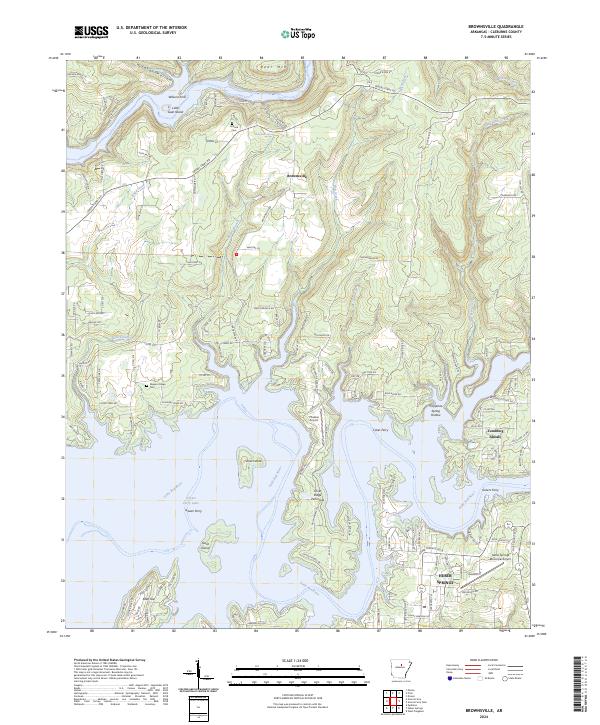
2024 Map of Brownsville
USGS Topo · Published 2024About this map
Greers Ferry Lake dominates the southern landscape of this Cleburne County quadrangle, where the Little Red River was impounded to create a complex shoreline of peninsulas and islands. The city of Heber Springs sits at the southeastern edge of the water, serving as a gateway to the recreational and residential developments that have reshaped the area, such as the resort community of Eden Isle. Despite the modern influence of the lake, traces of older settlement patterns remain visible in the north, centered around the community of Brownsville and established family landmarks like Holland Cem and Wilsons Ford. The map documents a transition from traditional rural Arkansas uplands, marked by names like Bear Mtn and Wildcat Hollow, to a landscape defined by water access and aviation, evidenced by both the Heber Springs Municipal Airport and the smaller Phalanx Airport.
Find a feature on this map
178 named features on this map. Tap any name to fly to it.
Don’t see what you’re looking for? This feature index may not catch every label — zoom into the map to look around manually.
Map Details
Editions of this 2024 Brownsville Map
This is the sole edition of this map. No revisions or reprints were ever made.
Other maps of this area

1890 · Batesville
USGS Topo · 1:125,000

1891 · Batesville
USGS Topo · 1:125,000

1892 · Mountain View
USGS Topo · 1:125,000

1894 · Mountain View
USGS Topo · 1:125,000

1953 · Memphis
USGS Topo · 1:250,000

1956 · Memphis
USGS Topo · 1:250,000

1956 · Russellville
USGS Topo · 1:250,000

1963 · Quitman
USGS Topo · 1:24,000

1963 · West Pangburn
USGS Topo · 1:24,000
1963 · Heber Springs
USGS Topo · 1:24,000