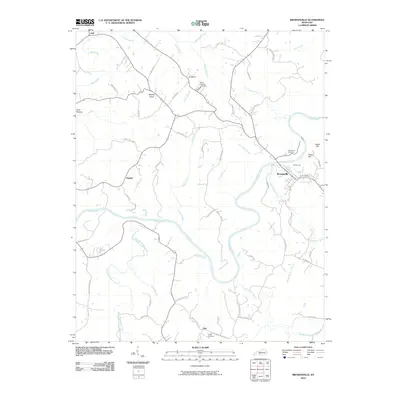
2010 Map of Brownsville
USGS Topo · Published 2010About this map
The Green River snakes through the center of this Edmonson County landscape, defining the topography of the region as it flows past Brownsville. The river's deep loops create distinctive landforms like Indian Hill and Potato Hill, while numerous tributaries such as Honey Creek and Beaverdam Creek carve through the surrounding terrain. Small settlements and crossroads communities like Asphalt, Grassland, and Nick are connected by a dense network of local routes, including Davis Ferry Rd and Pleasant Grove Rd. Genealogists will find several notable burial sites documented, including Holly Springs Cemetery, Alexander Cemetery, and Hawks Cemetery. The presence of Camp Joy near the river indicates the area's transition into a space for recreation and community gathering, while labels like Shipley Knob and Gulf Hollow capture the traditional place-names of this Kentucky interior.
Find a feature on this map
65 named features on this map. Tap any name to fly to it.
Don’t see what you’re looking for? This feature index may not catch every label — zoom into the map to look around manually.
Map Details
Editions of this 2010 Brownsville Map
This is the sole edition of this map. No revisions or reprints were ever made.
Other maps of this area

1922 · Leitchfield
USGS Topo · 1:48,000

1922 · Brownsville
USGS Topo · 1:62,500

1922 · Mammoth Cave
USGS Topo · 1:62,500

1923 · Mammoth Cave
USGS Topo · 1:62,500

1923 · Brownsville
USGS Topo · 1:62,500

1925 · Cub Run
USGS Topo · 1:62,500

1925 · Leitchfield
USGS Topo · 1:62,500

1953 · Ready
USGS Topo · 1:24,000

1953 · Bee Spring
USGS Topo · 1:24,000

1954 · Evansville
USGS Topo · 1:250,000