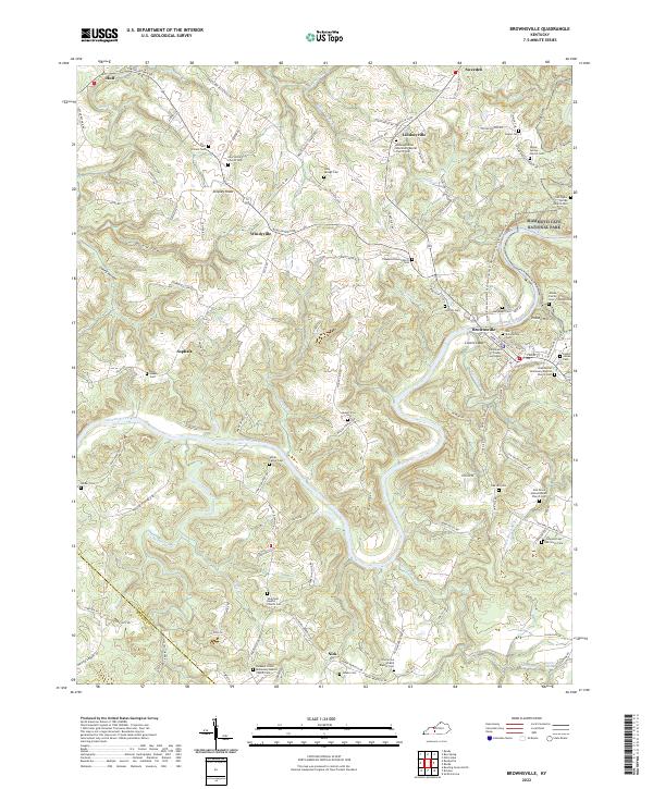
2022 Map of Brownsville
USGS Topo · Published 2022About this map
Brownsville serves as the focal point of this Kentucky landscape, situated where the Green River bends sharply near the Edmonson County Courthouse. The area is characterized by a dense network of upland ridges and deep drainages, including Gulf Hollow and Caney Hollow, that have long shaped the region's rural settlement patterns. To the east, the boundary of Mammoth Cave National Park is visible, highlighting the proximity of the community to this famous subterranean system.
Find a feature on this map
123 named features on this map. Tap any name to fly to it.
Don’t see what you’re looking for? This feature index may not catch every label — zoom into the map to look around manually.
Map Details
Editions of this 2022 Brownsville Map
This is the sole edition of this map. No revisions or reprints were ever made.
Other maps of this area

1922 · Leitchfield
USGS Topo · 1:48,000

1922 · Brownsville
USGS Topo · 1:62,500

1922 · Mammoth Cave
USGS Topo · 1:62,500

1923 · Mammoth Cave
USGS Topo · 1:62,500

1923 · Brownsville
USGS Topo · 1:62,500

1925 · Cub Run
USGS Topo · 1:62,500

1925 · Leitchfield
USGS Topo · 1:62,500

1953 · Ready
USGS Topo · 1:24,000

1953 · Bee Spring
USGS Topo · 1:24,000

1954 · Evansville
USGS Topo · 1:250,000