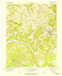
1954 Map of Brownsville
USGS Topo · Published 1955About this map
The Green River carves a deep, winding path through the heart of Edmonson County, anchoring the commercial and civic life of Brownsville. This 1954 topographic survey reveals a landscape where the eastern boundary is defined by Mammoth Cave National Park, while the surrounding hills are dotted with a dense network of country churches and small rural schools. Local industry is clearly marked by several instances of Asphalt Quarry, reflecting the region’s geological importance.
Find a feature on this map
46 named features on this map. Tap any name to fly to it.
Don’t see what you’re looking for? This feature index may not catch every label — zoom into the map to look around manually.
Map Details
Editions of this 1954 Brownsville Map
This is the sole edition of this map. No revisions or reprints were ever made.
Other maps of this area

1922 · Leitchfield
USGS Topo · 1:48,000

1922 · Brownsville
USGS Topo · 1:62,500

1922 · Mammoth Cave
USGS Topo · 1:62,500

1923 · Mammoth Cave
USGS Topo · 1:62,500

1923 · Brownsville
USGS Topo · 1:62,500

1925 · Cub Run
USGS Topo · 1:62,500

1925 · Leitchfield
USGS Topo · 1:62,500

1953 · Ready
USGS Topo · 1:24,000

1953 · Bee Spring
USGS Topo · 1:24,000

1954 · Evansville
USGS Topo · 1:250,000