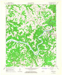
1965 Map of Brownsville
USGS Topo · Published 1967About this map
The Green River meanders in tight, dramatic oxbows through this mid-1960s survey of Edmonson County, carving a path that separates the town of Brownsville from the western reaches of Mammoth Cave National Park. The landscape is a complex network of ridges and hollows, such as Caney Hollow and Bear Gulf, where small settlements like Asphalt, Windyville, and Grassland are connected by narrow winding roads. The river’s importance to local infrastructure is visible at the Gaging Station Lock No 6, while the upland areas are dotted with numerous small country churches and cemeteries, reflecting the deep-rooted community history of the region.
Find a feature on this map
59 named features on this map. Tap any name to fly to it.
Don’t see what you’re looking for? This feature index may not catch every label — zoom into the map to look around manually.
Map Details
Editions of this 1965 Brownsville Map
This is the sole edition of this map. No revisions or reprints were ever made.
Other maps of this area

1922 · Leitchfield
USGS Topo · 1:48,000

1922 · Brownsville
USGS Topo · 1:62,500

1922 · Mammoth Cave
USGS Topo · 1:62,500

1923 · Mammoth Cave
USGS Topo · 1:62,500

1923 · Brownsville
USGS Topo · 1:62,500

1925 · Cub Run
USGS Topo · 1:62,500

1925 · Leitchfield
USGS Topo · 1:62,500

1953 · Ready
USGS Topo · 1:24,000

1953 · Bee Spring
USGS Topo · 1:24,000

1954 · Evansville
USGS Topo · 1:250,000