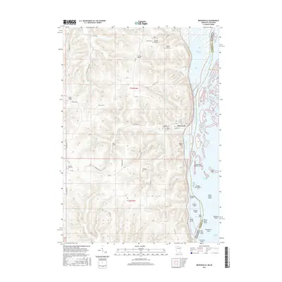
2016 Map of Brownsville
USGS Topo · Published 2016About this map
Brownsville sits at the base of the steep Wildcat Bluff, where the complex wetlands of the Mississippi River meet the rising interior ridges. This landscape is defined by its numerous small family and community burial grounds, such as the Christoph Hammer Family Cem, Neumann Family Cem, and Hackett's Grove Cem, which reflect generations of local settlement along the bluffs. The river itself is a maze of named islands and secondary channels like Coon Slough and Benover Slough. In the uplands, the topography is carved by drainages including Wildcat Creek and Brownsville Cr, separating prominent high ground such as German Ridge and Miller Ridge. The network of roads, from Cork Hollow Dr to Butterfield Valley Rd, follows the natural contours of these coulees and ridges, illustrating the enduring influence of the terrain on local transit.
Find a feature on this map
73 named features on this map. Tap any name to fly to it.
Don’t see what you’re looking for? This feature index may not catch every label — zoom into the map to look around manually.
Map Details
Editions of this 2016 Brownsville Map
This is the sole edition of this map. No revisions or reprints were ever made.
Other maps of this area

1926 · Stoddard
USGS Topo · 1:62,500

1927 · La Crosse
USGS Topo · 1:62,500

1930 · La Crescent
USGS Topo · 1:62,500

1930 · La Crosse
USGS Topo · 1:62,500

1956 · Brownsville
USGS Topo · 1:62,500

1956 · La Crescent
USGS Topo · 1:62,500

1958 · La Crosse
USGS Topo · 1:250,000

1961 · La Crosse
USGS Topo · 1:250,000
1963 · La Crosse
USGS Topo · 1:24,000
1963 · La Crosse
USGS Topo · 1:62,500