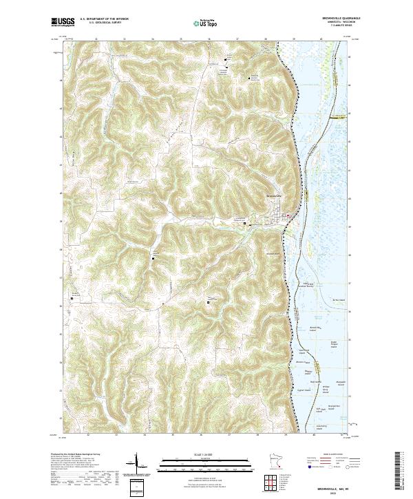
2022 Map of Brownsville
USGS Topo · Published 2022About this map
Brownsville sits at the base of the steep Wildcat Bluff on the western banks of the Mississippi River, where the landscape is defined by the sharp transition from the river valley to high timbered ridges. This 2022 survey captures the complex drainage of Wildcat Creek and Wildcat Cr as they cut through the upland terrain of German Ridge and Miller Ridge. The map is particularly notable for its high density of small family burial sites and community cemeteries, including the Christoph Hammer Family Cem, Frederick Hammer Family Cem, Neumann Family Cem, and Hackett's Grove Cem. Along the riverfront, the survey details the intricate network of backwaters and side channels, including Lawrence Lake and Coon Slough, as well as numerous named islands like Browns Island and Cygnet Island, reflecting the ever-shifting hydrology of the Upper Mississippi River valley.
Find a feature on this map
67 named features on this map. Tap any name to fly to it.
Don’t see what you’re looking for? This feature index may not catch every label — zoom into the map to look around manually.
Map Details
Editions of this 2022 Brownsville Map
This is the sole edition of this map. No revisions or reprints were ever made.
Other maps of this area

1926 · Stoddard
USGS Topo · 1:62,500

1927 · La Crosse
USGS Topo · 1:62,500

1930 · La Crescent
USGS Topo · 1:62,500

1930 · La Crosse
USGS Topo · 1:62,500

1956 · Brownsville
USGS Topo · 1:62,500

1956 · La Crescent
USGS Topo · 1:62,500

1958 · La Crosse
USGS Topo · 1:250,000

1961 · La Crosse
USGS Topo · 1:250,000
1963 · La Crosse
USGS Topo · 1:24,000
1963 · La Crosse
USGS Topo · 1:62,500