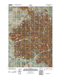
2011 Map of Brownsville
USGS Topo · Published 2011About this map
Brownsville sits at the southern edge of this Linn County landscape, where the Calapooia River flows past the Brownsville Dam and the Brownsville Post Office. This area preserves several significant sites for genealogists, including the Brownsville Pioneer Cemetery near the town center, and the Dodge Cemetery and Claypool Cemetery further north. The terrain is defined by a series of prominent rises like Washburn Butte, Lone Pine Butte, and Rock Hill, which separate the various drainages of Butte Creek and Cochran Creek. The map details a transition from the river valley floor to the elevated ridges of Cedar Butte and Robe Hill in the east, illustrating how the local road network, including Sand Ridge Rd and Middle Ridge Rd, follows the contours of the valley's edge.
Find a feature on this map
60 named features on this map. Tap any name to fly to it.
Don’t see what you’re looking for? This feature index may not catch every label — zoom into the map to look around manually.
Map Details
Editions of this 2011 Brownsville Map
This is the sole edition of this map. No revisions or reprints were ever made.
Other maps of this area

1909 · Rowland
USGS Topo · 1:31,680

1911 · Brownsville
USGS Topo · 1:31,680

1911 · Lebanon
USGS Topo · 1:31,680

1911 · Tangent
USGS Topo · 1:31,680

1912 · Halsey
USGS Topo · 1:62,500

1916 · Albany
USGS Topo · 1:62,500

1921 · Brownsville
USGS Topo · 1:62,500

1921 · Lebanon
USGS Topo · 1:62,500

1922 · Lebanon
USGS Topo · 1:48,000

1924 · Lebanon
USGS Topo · 1:62,500