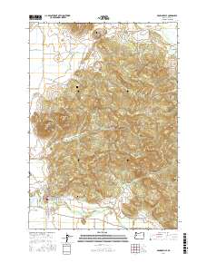
2017 Map of Brownsville
USGS Topo · Published 2017About this map
Brownsville sits at the southern edge of this valley landscape, where the Calapooia River emerges from the hills. The map highlights the town's early footprint and local heritage, notably through the Brownsville Pioneer Cem and the Brownsville Ditch which cuts through the settlement. Industrial history is evident near the river at the Schneider Log Pond, reflecting the timber and water-management systems essential to this Linn County community.
Find a feature on this map
82 named features on this map. Tap any name to fly to it.
Don’t see what you’re looking for? This feature index may not catch every label — zoom into the map to look around manually.
Map Details
Editions of this 2017 Brownsville Map
This is the sole edition of this map. No revisions or reprints were ever made.
Other maps of this area

1909 · Rowland
USGS Topo · 1:31,680

1911 · Brownsville
USGS Topo · 1:31,680

1911 · Lebanon
USGS Topo · 1:31,680

1911 · Tangent
USGS Topo · 1:31,680

1912 · Halsey
USGS Topo · 1:62,500

1916 · Albany
USGS Topo · 1:62,500

1921 · Brownsville
USGS Topo · 1:62,500

1921 · Lebanon
USGS Topo · 1:62,500

1922 · Lebanon
USGS Topo · 1:48,000

1924 · Lebanon
USGS Topo · 1:62,500