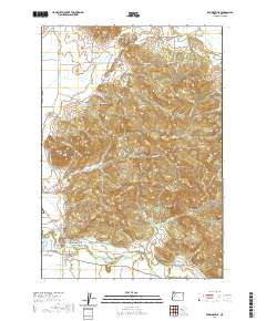
2020 Map of Brownsville
USGS Topo · Published 2020About this map
Brownsville sits at the base of the Calapooia foothills, where the Calapooia River emerges into the valley and feeds the historic Brownsville Ditch. This 2020 survey illustrates a landscape defined by prominent basalt features such as Peterson Butte, Washburn Butte, and Lone Pine Butte, which rise sharply above the surrounding agricultural and timber lands. For genealogists, the map identifies several significant resting places including the Brownsville Pioneer Cem, Claypool Cem, and Dodge Cem. To the northeast, the small community of Sodaville is shown at the edge of the hilly terrain. The map also records industrial and water-management features like the Schneider Log Pond and Kearns Reservoir, alongside an extensive network of rural routes such as Lebanon Brownsville Rd and Middle Ridge Dr that connect the isolated homesteads and farms of Linn County.
Find a feature on this map
79 named features on this map. Tap any name to fly to it.
Don’t see what you’re looking for? This feature index may not catch every label — zoom into the map to look around manually.
Map Details
Editions of this 2020 Brownsville Map
This is the sole edition of this map. No revisions or reprints were ever made.
Other maps of this area

1909 · Rowland
USGS Topo · 1:31,680

1911 · Brownsville
USGS Topo · 1:31,680

1911 · Lebanon
USGS Topo · 1:31,680

1911 · Tangent
USGS Topo · 1:31,680

1912 · Halsey
USGS Topo · 1:62,500

1916 · Albany
USGS Topo · 1:62,500

1921 · Brownsville
USGS Topo · 1:62,500

1921 · Lebanon
USGS Topo · 1:62,500

1922 · Lebanon
USGS Topo · 1:48,000

1924 · Lebanon
USGS Topo · 1:62,500