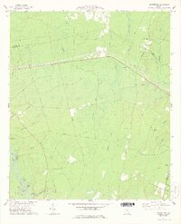
1978 Map of Browntown
USGS Topo · Published 1978About this map
Satilla River meanders through the southwestern corner of this coastal plain landscape, defining a network of oxbows and backwaters including Dead River, Basin Lake, and Gator Slough. The terrain is characterized by expansive wetland systems like Alligator Swamp and Briar Bay, which have long dictated the placement of roads and settlements. Small communities and named locales such as Browntown and Fendig are linked by historic thoroughfares like the Wire Road, while an Old Railroad Grade cutting through the center of the sheet hints at former timber or transport corridors now reclaimed by the pines.
Find a feature on this map
49 named features on this map. Tap any name to fly to it.
Don’t see what you’re looking for? This feature index may not catch every label — zoom into the map to look around manually.
Map Details
Editions of this 1978 Browntown Map
2 editions found
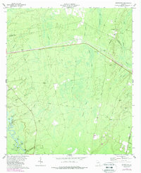
Other maps of this area

1917 · Nahunta
USGS Topo · 1:62,500

1918 · Hortense
USGS Topo · 1:62,500

1918 · Everett City
USGS Topo · 1:62,500

1918 · Nahunta
USGS Topo · 1:62,500

1918 · Bladen
USGS Topo · 1:62,500

1920 · Everett City
USGS Topo · 1:62,500

1939 · Bladen
USGS Topo · 1:62,500

1944 · Everett City
USGS Topo · 1:62,500

1944 · Hortense
USGS Topo · 1:62,500

1946 · Brunswick
USGS Topo · 1:250,000