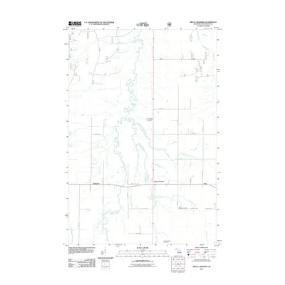
2011 Map of Bruce Crossing
USGS Topo · Published 2011About this map
The Bruce Crossing junction in Michigan's Upper Peninsula serves as the primary hub of this 2011 survey, situated where the Baltimore River and numerous tributaries like Clear Creek carve through the landscape. This region of Ontonagon County maintains a distinctly rural character, with the settlement of Balitmore to the west and Gem to the east. Local history is anchored at the Bruce Crossing Cemetery and the Bruce Crossing Post Office, which reflect the community's enduring geographic footprint. The drainage pattern is intricate, defined by uniquely named waterways such as Mile and One-half Creek and Saint Cullins Creek. While much of the area is crisscrossed by forest roads like 705 and 739, modern developments like the Perttus Big Spruce Golf Course appear alongside established family-named routes, including Jousma Rd and Nurkkala Rd.
Find a feature on this map
49 named features on this map. Tap any name to fly to it.
Don’t see what you’re looking for? This feature index may not catch every label — zoom into the map to look around manually.
Map Details
Editions of this 2011 Bruce Crossing Map
This is the sole edition of this map. No revisions or reprints were ever made.
Other maps of this area

1949 · Rockland
USGS Topo · 1:62,500

1951 · Rockland
USGS Topo · 1:62,500

1952 · Watersmeet
USGS Topo · 1:62,500

1952 · Thayer
USGS Topo · 1:62,500

1956 · Matchwood
USGS Topo · 1:62,500

1958 · Iron River
USGS Topo · 1:250,000

1960 · Iron River
USGS Topo · 1:250,000

1961 · Iron River
USGS Topo · 1:250,000

1967 · Iron River
USGS Topo · 1:250,000

1979 · Ontonagon
USGS Topo · 1:100,000