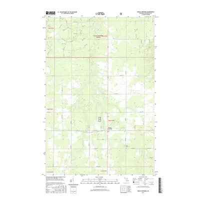
2017 Map of Bruce Crossing
USGS Topo · Published 2017About this map
Bruce Crossing serves as the central hub of this Upper Peninsula landscape, situated where several regional roads converge amidst the heavily forested terrain of the Ottawa National Forest. The settlement is defined by its proximity to the Baltimore River, which winds through the western half of the quadrangle. Local genealogy and history are anchored at the Bruce Crossing Cem, located south of the main village. The surrounding area is characterized by a dense network of forest service roads, such as Nfst-731 and Nfst-734, which provide access to the timberlands and numerous waterways including Saint Cullins Cr and Mile and One-half Creek. This topography reflects the region's enduring reliance on the forest products industry and a rural layout where family-named roads like Gauthier Rd and Larson Rd connect isolated homesteads to the primary transport corridors.
Find a feature on this map
67 named features on this map. Tap any name to fly to it.
Don’t see what you’re looking for? This feature index may not catch every label — zoom into the map to look around manually.
Map Details
Editions of this 2017 Bruce Crossing Map
This is the sole edition of this map. No revisions or reprints were ever made.
Other maps of this area

1949 · Rockland
USGS Topo · 1:62,500

1951 · Rockland
USGS Topo · 1:62,500

1952 · Watersmeet
USGS Topo · 1:62,500

1952 · Thayer
USGS Topo · 1:62,500

1956 · Matchwood
USGS Topo · 1:62,500

1958 · Iron River
USGS Topo · 1:250,000

1960 · Iron River
USGS Topo · 1:250,000

1961 · Iron River
USGS Topo · 1:250,000

1967 · Iron River
USGS Topo · 1:250,000

1979 · Ontonagon
USGS Topo · 1:100,000