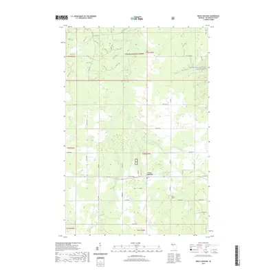
2019 Map of Bruce Crossing
USGS Topo · Published 2019About this map
Bruce Crossing serves as the central hub of this northern Michigan landscape, situated at the junction of several local routes in Ontonagon County. The settlement is surrounded by the dense woodlands of the Ottawa National Forest, where a complex network of forest service roads like Nfst-734 and Nfst-731-G provides access to the backcountry. The area is defined by its abundant water resources, including the Baltimore River and the protected corridor of the Ontonagon Wild and Scenic River. A legacy of rural land division and family settlement is visible in the named roads such as Lepponen, Sironen Rd, and Platzke Rd, which connect scattered homesteads to the village core and the Bruce Crossing Cem. The drainage patterns of Saint Collins Cr and Mile and One-half Creek illustrate the low-lying, well-watered character of this timber and agricultural region.
Find a feature on this map
65 named features on this map. Tap any name to fly to it.
Don’t see what you’re looking for? This feature index may not catch every label — zoom into the map to look around manually.
Map Details
Editions of this 2019 Bruce Crossing Map
This is the sole edition of this map. No revisions or reprints were ever made.
Other maps of this area

1949 · Rockland
USGS Topo · 1:62,500

1951 · Rockland
USGS Topo · 1:62,500

1952 · Watersmeet
USGS Topo · 1:62,500

1952 · Thayer
USGS Topo · 1:62,500

1956 · Matchwood
USGS Topo · 1:62,500

1958 · Iron River
USGS Topo · 1:250,000

1960 · Iron River
USGS Topo · 1:250,000

1961 · Iron River
USGS Topo · 1:250,000

1967 · Iron River
USGS Topo · 1:250,000

1979 · Ontonagon
USGS Topo · 1:100,000