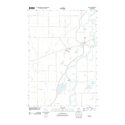
2010 Map of Bruce
USGS Topo · Published 2010About this map
The Chippewa River flows through this Rusk County landscape, defining the character of the village of Bruce and the nearby settlement of Apollonia. By the early 21st century, the area displays a mix of riparian hydrology and small-town infrastructure, with the river joined by several tributaries including Devils Creek and Alder Creek. Significant for local historians, the map identifies four distinct burial grounds: Saint Marys Cemetery, Bruce Protestant Cemetery, and both the Apollonia Protestant and Catholic cemeteries.
Find a feature on this map
59 named features on this map. Tap any name to fly to it.
Don’t see what you’re looking for? This feature index may not catch every label — zoom into the map to look around manually.
Map Details
Editions of this 2010 Bruce Map
This is the sole edition of this map. No revisions or reprints were ever made.
Other maps of this area

1944 · Exeland
USGS Topo · 1:48,000

1945 · Meteor
USGS Topo · 1:48,000

1947 · Exeland
USGS Topo · 1:48,000

1948 · Weyerhauser
USGS Topo · 1:48,000

1948 · Ladysmith
USGS Topo · 1:48,000

1949 · Meteor
USGS Topo · 1:48,000

1950 · Weyerhauser
USGS Topo · 1:48,000

1950 · Ladysmith
USGS Topo · 1:48,000

1953 · Rice Lake
USGS Topo · 1:250,000

1959 · Rice Lake
USGS Topo · 1:250,000