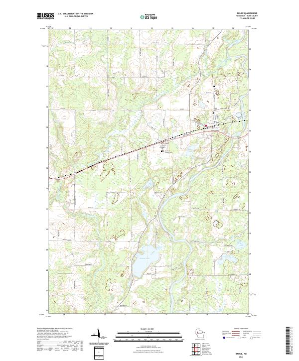
2022 Map of Bruce
USGS Topo · Published 2022About this map
The Chippewa River carves a winding path through the heart of this Rusk County landscape, anchoring a complex drainage system that includes Devils Creek and Soft Maple Creek. The village of Bruce serves as the primary settlement, positioned where local roads and rail corridors intersect north of the river. A cluster of burial sites, including Saint Marys Cemetery and the dual Apollonia Protestant and Catholic Cemeteries, provides significant points of interest for genealogists and local historians documenting the early families of this region.
Find a feature on this map
81 named features on this map. Tap any name to fly to it.
Don’t see what you’re looking for? This feature index may not catch every label — zoom into the map to look around manually.
Map Details
Editions of this 2022 Bruce Map
This is the sole edition of this map. No revisions or reprints were ever made.
Other maps of this area

1944 · Exeland
USGS Topo · 1:48,000

1945 · Meteor
USGS Topo · 1:48,000

1947 · Exeland
USGS Topo · 1:48,000

1948 · Weyerhauser
USGS Topo · 1:48,000

1948 · Ladysmith
USGS Topo · 1:48,000

1949 · Meteor
USGS Topo · 1:48,000

1950 · Weyerhauser
USGS Topo · 1:48,000

1950 · Ladysmith
USGS Topo · 1:48,000

1953 · Rice Lake
USGS Topo · 1:250,000

1959 · Rice Lake
USGS Topo · 1:250,000