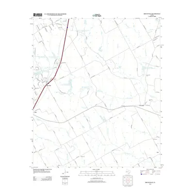
2012 Map of Bruceville
USGS Topo · Published 2012About this map
Bruceville and the nearby community of Eddy sit along a primary transportation corridor in Central Texas, where the landscape is defined by the branching tributaries of Cow Bayou. This 2012 survey illustrates a rural region heavily managed by water conservation efforts, evidenced by numerous facilities such as Soil Conservation Service Site 27 Reservoir and Soil Conservation Service Site 28 Reservoir. These reservoirs neighbor agricultural lands drained by long, winding waterways like Cottonwood Cr and Indian Grave Cr.
Find a feature on this map
108 named features on this map. Tap any name to fly to it.
Don’t see what you’re looking for? This feature index may not catch every label — zoom into the map to look around manually.
Map Details
Editions of this 2012 Bruceville Map
This is the sole edition of this map. No revisions or reprints were ever made.
Other maps of this area

1892 · Temple
USGS Topo · 1:125,000

1931 · Mc Gregor
USGS Topo · 1:62,500

1931 · Belton
USGS Topo · 1:62,500

1954 · Waco
USGS Topo · 1:250,000

1955 · Waco
USGS Topo · 1:250,000

1957 · Bruceville
USGS Topo · 1:24,000

1957 · Lorena
USGS Topo · 1:24,000

1957 · Chilton
USGS Topo · 1:24,000
1957 · Robinson
USGS Topo · 1:24,000
1963 · Lott
USGS Topo · 1:24,000