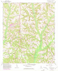
1960 Map of Brundidge NW
USGS Topo · Published 1981About this map
Spring Hill and Tarentum anchor this rural Pike County landscape as it appeared during the mid-20th century. The area is defined by a high density of community centers, particularly numerous churches such as Turner Chapel, Bethlehem Ch, and White Rock Ch. These nodes of local life are connected by a network of unimproved roads and light-duty routes that navigate the drainage basins of Whitewater Creek and Walnut Creek.
Find a feature on this map
28 named features on this map. Tap any name to fly to it.
Don’t see what you’re looking for? This feature index may not catch every label — zoom into the map to look around manually.
Map Details
Editions of this 1960 Brundidge NW Map
2 editions found

Other maps of this area

1948 · Brundidge
USGS Topo · 1:62,500

1950 · Brundidge
USGS Topo · 1:62,500

1953 · Andalusia
USGS Topo · 1:250,000

1953 · Dothan
USGS Topo · 1:250,000

1954 · Dothan
USGS Topo · 1:250,000

1955 · Dothan
USGS Topo · 1:250,000

1957 · Andalusia
USGS Topo · 1:250,000

1960 · Brundidge
USGS Topo · 1:24,000

1960 · Brundidge SE
USGS Topo · 1:24,000

1960 · Victoria
USGS Topo · 1:24,000