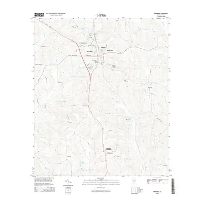
2014 Map of Brundidge
USGS Topo · Published 2014About this map
Brundidge serves as the primary hub in this southern Alabama landscape, where the intersection of Us-231 and Al-93 anchors a network of rural communities including Hillcrest, Broad View, and Green Ridge. The terrain is defined by its water system, with Whitewater Cr flowing through the northwest and the winding course of Bowden Mill Cr draining the southeastern reaches toward Harris Lake.
Find a feature on this map
87 named features on this map. Tap any name to fly to it.
Don’t see what you’re looking for? This feature index may not catch every label — zoom into the map to look around manually.
Map Details
Editions of this 2014 Brundidge Map
This is the sole edition of this map. No revisions or reprints were ever made.
Other maps of this area

1948 · Brundidge
USGS Topo · 1:62,500

1950 · Brundidge
USGS Topo · 1:62,500

1953 · Dothan
USGS Topo · 1:250,000

1954 · Dothan
USGS Topo · 1:250,000

1955 · Dothan
USGS Topo · 1:250,000

1960 · Brundidge
USGS Topo · 1:24,000

1960 · Brundidge SE
USGS Topo · 1:24,000

1960 · Victoria
USGS Topo · 1:24,000

1960 · Brundidge NW
USGS Topo · 1:24,000

1962 · Brundidge
USGS Topo · 1:25,000
Featured Places
- Brundidge, AL
- Broad View, Brundidge
- Pierson Subdivision, Brundidge
- Hamilton Crossroads, AL
- Caldwell Subdivision, Brundidge