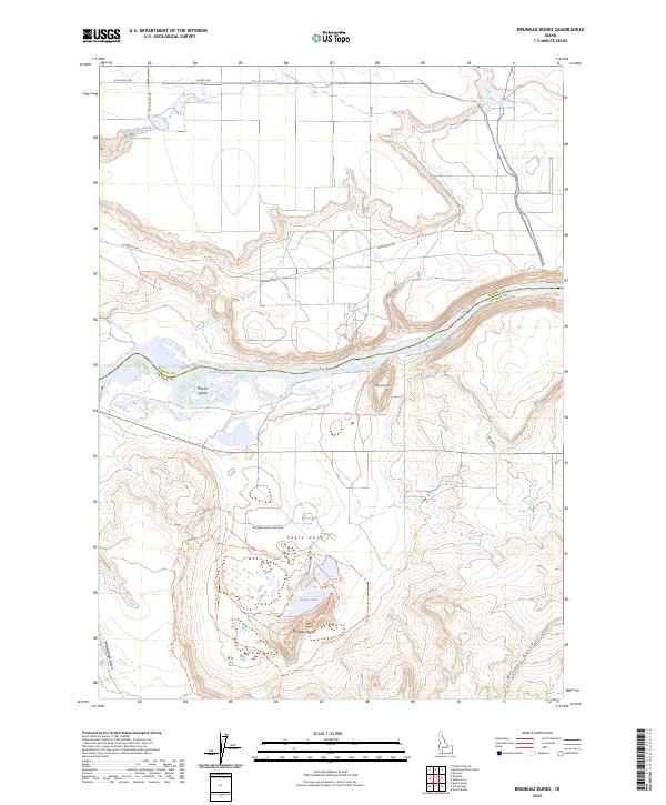
2023 Map of Bruneau Dunes
USGS Topo · Published 2023About this map
Bruneau Dunes dominate the southern portion of this landscape, where specialized trails like the Top of Dune Hiking Trl and Education Center Trl wind through the sand. This desert environment is anchored by Dunes Lake and Eagle Cove, providing a sharp contrast to the irrigated agricultural lands to the north. The boundary between Owyhee Co and Elmore Co follows the course of the Snake River, which widens into the C J Strike Reservoir near Wilkins Island.
Find a feature on this map
29 named features on this map. Tap any name to fly to it.
Don’t see what you’re looking for? This feature index may not catch every label — zoom into the map to look around manually.
Map Details
Editions of this 2023 Bruneau Dunes Map
This is the sole edition of this map. No revisions or reprints were ever made.
Other maps of this area

1892 · Mountain Home
USGS Topo · 1:125,000

1893 · Mountain Home
USGS Topo · 1:125,000

1947 · Bruneau
USGS Topo · 1:62,500

1947 · Indian Cove
USGS Topo · 1:24,000

1947 · Sand Dunes
USGS Topo · 1:24,000

1947 · Bruneau
USGS Topo · 1:24,000

1947 · Sugar Valley
USGS Topo · 1:24,000

1947 · Hot Spring
USGS Topo · 1:24,000

1948 · Sand Dunes
USGS Topo · 1:24,000

1948 · Indian Cove
USGS Topo · 1:24,000