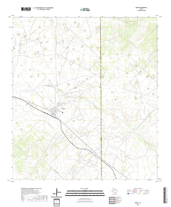
2022 Map of Bruni
USGS Topo · Published 2022About this map
Bruni serves as the primary settlement on this South Texas landscape, situated along the southern edge of the Webb County line. The town's grid is clearly defined by residential streets such as Avenue E and E Third St, while the local genealogy is anchored at the Bruni Cem. This portion of the Brush Country is defined by a dendritic drainage pattern where the intermittent Arroyo de los Angeles winds eastward across the quadrangle. The surrounding terrain is largely dominated by ranching infrastructure, connected by corridors like Ranch Rd 2050 and Ranch Rd 8072A. This modern topographic survey illustrates the enduring rural character of the region, where the town remains a lonely outpost amidst the vast network of drainage draws and ranch tracks.
Find a feature on this map
14 named features on this map. Tap any name to fly to it.
Don’t see what you’re looking for? This feature index may not catch every label — zoom into the map to look around manually.
Map Details
Editions of this 2022 Bruni Map
This is the sole edition of this map. No revisions or reprints were ever made.
Other maps of this area

1939 · Bruni
USGS Topo · 1:62,500

1956 · Laredo
USGS Topo · 1:250,000

1967 · Hebbronville NW
USGS Topo · 1:24,000

1967 · Hebbronville
USGS Topo · 1:24,000

1968 · Parrilla Creek SW
USGS Topo · 1:24,000
1968 · Mills Bennett SW
USGS Topo · 1:24,000

1968 · San Pablo
USGS Topo · 1:24,000

1972 · Albercas Ranch
USGS Topo · 1:24,000

1972 · Bruni SE
USGS Topo · 1:24,000
1972 · Bruni
USGS Topo · 1:24,000