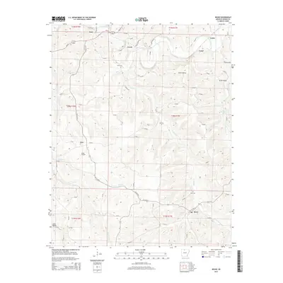
2014 Map of Bruno
USGS Topo · Published 2014About this map
Crooked Creek meanders through the northern hills of Marion County, anchoring a landscape defined by small Ozark communities and family-named hollows. The settlement of Pyatt occupies the northwest corner near the creek, while the namesake town of Bruno sits to the southeast. The terrain transitions from the open stretches of Kings Prairie to deeply carved valleys like Parker Hollow, illustrating the rural settlement patterns common to northern Arkansas.
Find a feature on this map
72 named features on this map. Tap any name to fly to it.
Don’t see what you’re looking for? This feature index may not catch every label — zoom into the map to look around manually.
Map Details
Editions of this 2014 Bruno Map
This is the sole edition of this map. No revisions or reprints were ever made.
Other maps of this area

1893 · Yellville
USGS Topo · 1:125,000

1903 · Yellville
USGS Topo · 1:125,000

1905 · Yellville
USGS Topo · 1:125,000

1929 · Yellville
USGS Topo · 1:125,000

1945 · Harrison
USGS Topo · 1:250,000

1949 · Harrison
USGS Topo · 1:250,000

1954 · Harrison
USGS Topo · 1:250,000

1958 · Harrison
USGS Topo · 1:250,000

1964 · Harrison
USGS Topo · 1:250,000
1966 · Yellville
USGS Topo · 1:24,000