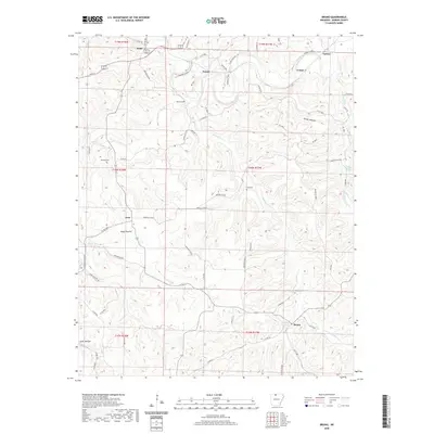
2020 Map of Bruno
USGS Topo · Published 2020About this map
Pyatt and the surrounding rural communities of Marion County are defined by the winding valley of Crooked Creek and its many spring-fed tributaries. This landscape is characterized by a network of small settlements and hollows, including Parker Hollow and Jones Hollow, which illustrate the traditional upland settlement patterns of northern Arkansas. Local genealogy is anchored by several well-preserved burial grounds such as Bruno Cem, Patton Cem, Stanley Cem, and Hall Cem, each marking a corner of this highland community. The presence of Ebbing Springs and Ozark Mountain Spring highlights the importance of karst hydrology in the region's development. Small clusters of residences and historical sites are found at Eros, Comal, and Kings Prairie, connected by a web of local roads like Marion Co 4018 and Sharps Bend Rd that trace the ridges and creek bottoms.
Find a feature on this map
81 named features on this map. Tap any name to fly to it.
Don’t see what you’re looking for? This feature index may not catch every label — zoom into the map to look around manually.
Map Details
Editions of this 2020 Bruno Map
This is the sole edition of this map. No revisions or reprints were ever made.
Other maps of this area

1893 · Yellville
USGS Topo · 1:125,000

1903 · Yellville
USGS Topo · 1:125,000

1905 · Yellville
USGS Topo · 1:125,000

1929 · Yellville
USGS Topo · 1:125,000

1945 · Harrison
USGS Topo · 1:250,000

1949 · Harrison
USGS Topo · 1:250,000

1954 · Harrison
USGS Topo · 1:250,000

1958 · Harrison
USGS Topo · 1:250,000

1964 · Harrison
USGS Topo · 1:250,000
1966 · Yellville
USGS Topo · 1:24,000