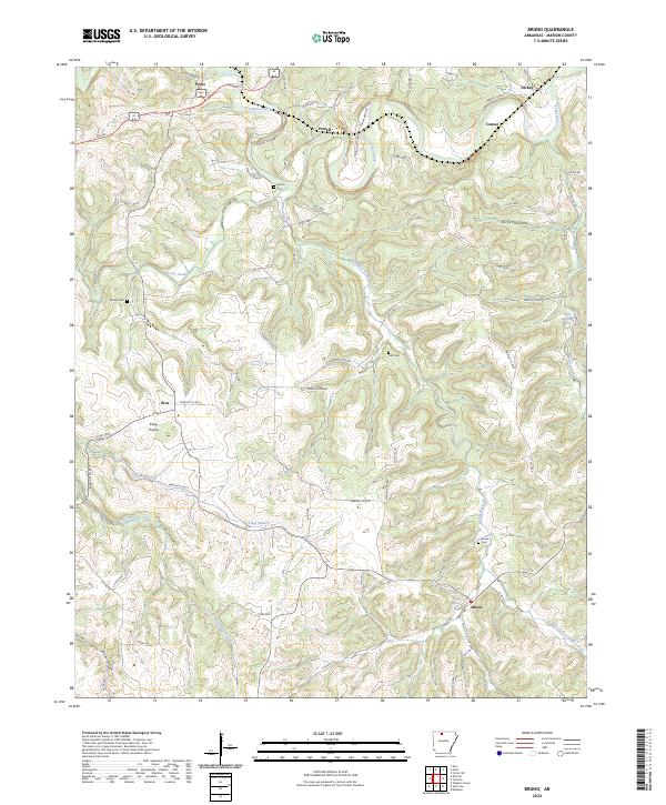
2024 Map of Bruno
USGS Topo · Published 2024About this map
Crooked Creek winds through the northern reaches of this Marion County landscape, anchoring a network of valley settlements that define the region's rural character. The map centers on the small communities of Bruno and Eros, where the terrain transitions into the distinct topography of Kings Prairie. Evidence of early Ozark settlement is preserved through numerous family and community burial grounds, including Bruno Cem, Patton Cem, Stanley Cem, and Hall Cem. The drainage patterns of Kings Branch and Hampton Creek illustrate how the local geography dictated the placement of homesteads and roads like Sharps Bend Rd and St Claire Trl. This modern survey provides a clear view of the persistent rural layout of northern Arkansas, where named springs like Ozark Mountain Spring and Ebbing Springs remain vital landmarks in the wooded hollows.
Find a feature on this map
75 named features on this map. Tap any name to fly to it.
Don’t see what you’re looking for? This feature index may not catch every label — zoom into the map to look around manually.
Map Details
Editions of this 2024 Bruno Map
This is the sole edition of this map. No revisions or reprints were ever made.
Other maps of this area

1893 · Yellville
USGS Topo · 1:125,000

1903 · Yellville
USGS Topo · 1:125,000

1905 · Yellville
USGS Topo · 1:125,000

1929 · Yellville
USGS Topo · 1:125,000

1945 · Harrison
USGS Topo · 1:250,000

1949 · Harrison
USGS Topo · 1:250,000

1954 · Harrison
USGS Topo · 1:250,000

1958 · Harrison
USGS Topo · 1:250,000

1964 · Harrison
USGS Topo · 1:250,000
1966 · Yellville
USGS Topo · 1:24,000