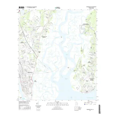
2017 Map of Brunswick East
USGS Topo · Published 2017About this map
Brunswick and the surrounding coastal landscape are defined by a complex network of tidal waterways, including the Mackay River and the Back River. This 2017 study illustrates the intersection of historic preservation and modern infrastructure, with the Fort Frederica National Monument situated on the western edge of Saint Simons Island. Local heritage is preserved in sites like Jewtown and several traditional burial grounds such as Oak Grove Cem and Stranger Cem. The geography is dominated by the Marshes of Glynn, a vast wetland system that separates the mainland from the barrier islands. Significant landmarks include the McKinnon St Simons Island Airport and the strategic Gascoigne Bluff overlooking the Intracoastal Waterway, reflecting the area's long history as a maritime and transport hub.
Find a feature on this map
261 named features on this map. Tap any name to fly to it.
Don’t see what you’re looking for? This feature index may not catch every label — zoom into the map to look around manually.
Map Details
Editions of this 2017 Brunswick East Map
This is the sole edition of this map. No revisions or reprints were ever made.
Other maps of this area

1918 · Everett City
USGS Topo · 1:62,500

1918 · Bladen
USGS Topo · 1:62,500

1920 · Everett City
USGS Topo · 1:62,500

1921 · Darien
USGS Topo · 1:62,500

1939 · Bladen
USGS Topo · 1:62,500

1944 · Everett City
USGS Topo · 1:62,500

1945 · Brunswick
USGS Topo · 1:62,500

1946 · Brunswick
USGS Topo · 1:250,000

1948 · Brunswick
USGS Topo · 1:250,000

1954 · Altamaha Sound
USGS Topo · 1:24,000