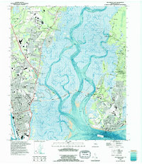
1993 Map of Brunswick East
USGS Topo · Published 1995About this map
The Marshes of Glynn sweep across this coastal landscape, separating the mainland city of Brunswick from the barrier islands. This mid-1990s survey illustrates a complex environment of tidal waterways, including the Mackay River and Frederica River, which define the Intracoastal Waterway route. On the mainland, the Federal Law Enforcement Training Center occupies a significant tract north of the city center, while the historic heart of Brunswick maintains its grid near Oak Grove Cemetery and Glynn Academy.
Find a feature on this map
67 named features on this map. Tap any name to fly to it.
Don’t see what you’re looking for? This feature index may not catch every label — zoom into the map to look around manually.
Map Details
Editions of this 1993 Brunswick East Map
This is the sole edition of this map. No revisions or reprints were ever made.
Other maps of this area

1918 · Everett City
USGS Topo · 1:62,500

1918 · Bladen
USGS Topo · 1:62,500

1920 · Everett City
USGS Topo · 1:62,500

1921 · Darien
USGS Topo · 1:62,500

1939 · Bladen
USGS Topo · 1:62,500

1944 · Everett City
USGS Topo · 1:62,500

1945 · Brunswick
USGS Topo · 1:62,500

1946 · Brunswick
USGS Topo · 1:250,000

1948 · Brunswick
USGS Topo · 1:250,000

1954 · Altamaha Sound
USGS Topo · 1:24,000