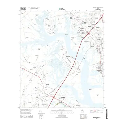
2014 Map of Brunswick West
USGS Topo · Published 2014About this map
The Turtle River and its intricate network of marshes and islands define the landscape west of Brunswick. This coastal environment is marked by significant landforms such as Visavis Island, Hermitage Island, and Colonels Island, which are separated by a complex system of sloughs and creeks including Hillery Slough and Burnett Creek. The transition from the tidal wetlands to established upland settlements is visible through residential pockets like Clover Heights, Glendale Gardens, and Deerwood.
Find a feature on this map
225 named features on this map. Tap any name to fly to it.
Don’t see what you’re looking for? This feature index may not catch every label — zoom into the map to look around manually.
Map Details
Editions of this 2014 Brunswick West Map
This is the sole edition of this map. No revisions or reprints were ever made.
Other maps of this area

1918 · Everett City
USGS Topo · 1:62,500

1918 · Bladen
USGS Topo · 1:62,500

1920 · Everett City
USGS Topo · 1:62,500

1921 · Darien
USGS Topo · 1:62,500

1939 · Bladen
USGS Topo · 1:62,500

1944 · Everett City
USGS Topo · 1:62,500

1945 · Brunswick
USGS Topo · 1:62,500

1946 · Brunswick
USGS Topo · 1:250,000

1948 · Brunswick
USGS Topo · 1:250,000
1956 · Bladen
USGS Topo · 1:24,000