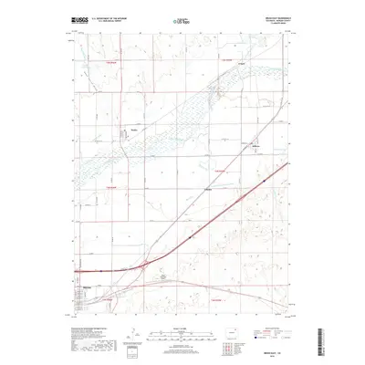
2019 Map of Brush East
USGS Topo · Published 2019About this map
Brush anchors the southwestern corner of this survey, where the town's street grid meets the agricultural landscape of eastern Morgan County. The South Platte River winds across the northern half of the region, its course paralleled by an intricate system of irrigation infrastructure including the Riverside Ditch, Snyder Canal, and the North Sterling Canal. These waterworks reflect the intensive land use required to support settlements like Snyder and Hillrose in the high plains. South of the river, the landscape is defined by the broad drainage of Beaver Creek and the transportation corridor following the railroad and highway through Camden. The presence of the Brush Municipal Airport and several localized reservoirs like Costelloe Reservoir and Emmerson Lake highlight the intersection of aviation, water management, and rural commerce in this portion of the Colorado plains.
Find a feature on this map
62 named features on this map. Tap any name to fly to it.
Don’t see what you’re looking for? This feature index may not catch every label — zoom into the map to look around manually.
Map Details
Editions of this 2019 Brush East Map
This is the sole edition of this map. No revisions or reprints were ever made.
Other maps of this area

1951 · Dead Horse Springs
USGS Topo · 1:24,000

1951 · Messex
USGS Topo · 1:24,000

1951 · Brush West
USGS Topo · 1:24,000

1951 · Antelope Springs
USGS Topo · 1:24,000

1951 · Merino SW
USGS Topo · 1:24,000

1951 · Brush East
USGS Topo · 1:24,000

1954 · Sterling
USGS Topo · 1:250,000

1958 · Sterling
USGS Topo · 1:250,000

1963 · Round Top
USGS Topo · 1:24,000

1965 · Miller Ranch
USGS Topo · 1:24,000