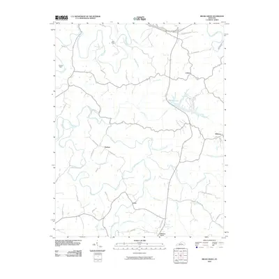
2010 Map of Brush Grove
USGS Topo · Published 2010About this map
Willisburg sits at the eastern edge of this landscape, where the headwaters of Lick Creek flow toward the recently developed Willisburg Lake. The geography is defined by a dendritic network of streams, notably the Chaplin River in the northwest and Beech Fork to the south, which carve through terrain marked by features like Holt Ridge and the Cooney Neck bend. This 2010 survey reflects a rural Kentucky environment where small settlements like Hardesty, Litsey, and Pulliam are connected by a web of local roads named for established families, such as Haydon Bros Rd and Mayes Creek Rd. The presence of the Blue Grass Pkwy across the northern section contrasts with the winding paths of Old Kentucky 53, showing the layer of modern transit over a traditional agricultural and riparian layout.
Find a feature on this map
50 named features on this map. Tap any name to fly to it.
Don’t see what you’re looking for? This feature index may not catch every label — zoom into the map to look around manually.
Map Details
Editions of this 2010 Brush Grove Map
This is the sole edition of this map. No revisions or reprints were ever made.
Other maps of this area

1952 · Ashbrook
USGS Topo · 1:24,000

1952 · Chaplin
USGS Topo · 1:24,000

1953 · Mackville
USGS Topo · 1:24,000

1953 · Brush Grove
USGS Topo · 1:24,000

1953 · Maud
USGS Topo · 1:24,000

1953 · Saint Catharine
USGS Topo · 1:24,000

1953 · Cardwell
USGS Topo · 1:24,000

1953 · Springfield
USGS Topo · 1:24,000

1953 · Bloomfield
USGS Topo · 1:24,000

1957 · Winchester
USGS Topo · 1:250,000