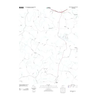
2013 Map of Brush Grove
USGS Topo · Published 2013About this map
Willisburg Lake and the winding course of the Beech Fork define this portion of Washington County, where the landscape is etched by a complex network of creeks and ridges. Small settlements and crossroads like Brush Grove, Polin, and Hardesty are connected by narrow ridge roads such as McCann Ridge Ln and Kirsh Ridge Rd. The terrain is characterized by deep drainages including Long Lick Cr and Mays Cr, with prominent elevations like Holt Ridge overlooking the watercourses. Further north, the Bluegrass Pkwy cuts across the drainage of the Chaplin River, contrasting the modern transportation corridor with the established rural hamlets of Pulliam and Tatham Springs. Family-named landmarks and local lanes like John Kirsh Rd and Red Store Ln reflect the persistent agricultural and residential patterns of this central Kentucky region.
Find a feature on this map
85 named features on this map. Tap any name to fly to it.
Don’t see what you’re looking for? This feature index may not catch every label — zoom into the map to look around manually.
Map Details
Editions of this 2013 Brush Grove Map
This is the sole edition of this map. No revisions or reprints were ever made.
Other maps of this area

1952 · Ashbrook
USGS Topo · 1:24,000

1952 · Chaplin
USGS Topo · 1:24,000

1953 · Mackville
USGS Topo · 1:24,000

1953 · Brush Grove
USGS Topo · 1:24,000

1953 · Maud
USGS Topo · 1:24,000

1953 · Saint Catharine
USGS Topo · 1:24,000

1953 · Cardwell
USGS Topo · 1:24,000

1953 · Springfield
USGS Topo · 1:24,000

1953 · Bloomfield
USGS Topo · 1:24,000

1957 · Winchester
USGS Topo · 1:250,000