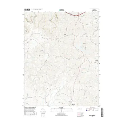
2016 Map of Brush Grove
USGS Topo · Published 2016About this map
The rolling agricultural landscape of Washington County and Nelson County is defined by a dense network of watercourses and small rural settlements. Communities such as Willisburg, Hardesty, and Pulliam are connected by numerous ridge-line roads including McCann Ridge Ln and Cedar Ridge Rd. The northern portion of the map is intersected by the Bluegrass Pkwy, contrasting with the more traditional riverine geography of the Chaplin River and Beech Fork. Near the southern edge, the Pleasant Grove Church Cem serves as a significant landmark for genealogical research. Water features like Willisburg Lake and several named branches, including Steep Hollow Br and Birdtown Br, illustrate the complex drainage patterns of this central Kentucky region during the mid-2010s.
Find a feature on this map
70 named features on this map. Tap any name to fly to it.
Don’t see what you’re looking for? This feature index may not catch every label — zoom into the map to look around manually.
Map Details
Editions of this 2016 Brush Grove Map
This is the sole edition of this map. No revisions or reprints were ever made.
Other maps of this area

1952 · Ashbrook
USGS Topo · 1:24,000

1952 · Chaplin
USGS Topo · 1:24,000

1953 · Mackville
USGS Topo · 1:24,000

1953 · Brush Grove
USGS Topo · 1:24,000

1953 · Maud
USGS Topo · 1:24,000

1953 · Saint Catharine
USGS Topo · 1:24,000

1953 · Cardwell
USGS Topo · 1:24,000

1953 · Springfield
USGS Topo · 1:24,000

1953 · Bloomfield
USGS Topo · 1:24,000

1957 · Winchester
USGS Topo · 1:250,000