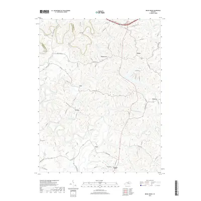
2019 Map of Brush Grove
USGS Topo · Published 2019About this map
Willisburg and the surrounding rural hamlets of Washington County are defined by a complex network of creeks and ridges. The Chaplin River cuts across the northern landscape near Holt Ridge, while the southern reaches are drained by Beech Fork and Long Lick Creek. This 2019 survey shows the persistent agricultural character of the region, where small settlements like Hardesty, Polin, and Brush Grove are linked by winding local routes such as Beechland Rd and Polin Rd. The topography is particularly intricate at Cooney Neck, where the landscape drops sharply toward the water. Local heritage is anchored at the southern edge by the Pleasant Grove Church Cem, situated near the community of Pleasant Grove. The map details the transition from the modern transit corridor of the Bluegrass Parkway in the north to the more secluded valley reaches of Lincoln Run and Steep Hollow Br.
Find a feature on this map
77 named features on this map. Tap any name to fly to it.
Don’t see what you’re looking for? This feature index may not catch every label — zoom into the map to look around manually.
Map Details
Editions of this 2019 Brush Grove Map
This is the sole edition of this map. No revisions or reprints were ever made.
Other maps of this area

1952 · Ashbrook
USGS Topo · 1:24,000

1952 · Chaplin
USGS Topo · 1:24,000

1953 · Mackville
USGS Topo · 1:24,000

1953 · Brush Grove
USGS Topo · 1:24,000

1953 · Maud
USGS Topo · 1:24,000

1953 · Saint Catharine
USGS Topo · 1:24,000

1953 · Cardwell
USGS Topo · 1:24,000

1953 · Springfield
USGS Topo · 1:24,000

1953 · Bloomfield
USGS Topo · 1:24,000

1957 · Winchester
USGS Topo · 1:250,000