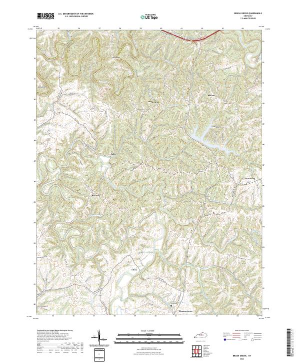
2022 Map of Brush Grove
USGS Topo · Published 2022About this map
The Chaplin River and its numerous tributaries, including McCann Br and Grove Br, carve through the undulating landscape along the Washington County and Nelson County line. This 2022 survey illustrates the resilient rural character of the region, where family-named landmarks like Holt Ridge and Cooney Neck define the local geography. Small, historically significant settlements are scattered throughout the quadrangle, including Brush Grove, Pulliam, and Polin, connected by a network of winding ridge roads and valley lanes.
Find a feature on this map
81 named features on this map. Tap any name to fly to it.
Don’t see what you’re looking for? This feature index may not catch every label — zoom into the map to look around manually.
Map Details
Editions of this 2022 Brush Grove Map
This is the sole edition of this map. No revisions or reprints were ever made.
Other maps of this area

1952 · Ashbrook
USGS Topo · 1:24,000

1952 · Chaplin
USGS Topo · 1:24,000

1953 · Mackville
USGS Topo · 1:24,000

1953 · Brush Grove
USGS Topo · 1:24,000

1953 · Maud
USGS Topo · 1:24,000

1953 · Saint Catharine
USGS Topo · 1:24,000

1953 · Cardwell
USGS Topo · 1:24,000

1953 · Springfield
USGS Topo · 1:24,000

1953 · Bloomfield
USGS Topo · 1:24,000

1957 · Winchester
USGS Topo · 1:250,000