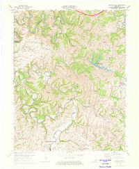
1972 Map of Brush Grove
USGS Topo · Published 1974About this map
Lincoln Homestead State Park anchors the southern reaches of this landscape, marking the historic ties of the Lincoln family to the Beech Fork river valley. The terrain is defined by the tight, serpentine meanders of the Chaplin River and Beech Fork, where water has carved deep into the limestone of Muldraughs Hill. These winding watercourses dictate the placement of early settlements and rural infrastructure, with small communities like Brush Grove and Hardesty situated along the high ridges above the river bends.
Find a feature on this map
32 named features on this map. Tap any name to fly to it.
Don’t see what you’re looking for? This feature index may not catch every label — zoom into the map to look around manually.
Map Details
Editions of this 1972 Brush Grove Map
This is the sole edition of this map. No revisions or reprints were ever made.
Other maps of this area

1952 · Ashbrook
USGS Topo · 1:24,000

1952 · Chaplin
USGS Topo · 1:24,000

1953 · Mackville
USGS Topo · 1:24,000

1953 · Brush Grove
USGS Topo · 1:24,000

1953 · Maud
USGS Topo · 1:24,000

1953 · Saint Catharine
USGS Topo · 1:24,000

1953 · Cardwell
USGS Topo · 1:24,000

1953 · Springfield
USGS Topo · 1:24,000

1953 · Bloomfield
USGS Topo · 1:24,000

1957 · Winchester
USGS Topo · 1:250,000