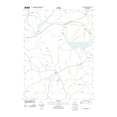
2010 Map of Brush Valley
USGS Topo · Published 2010About this map
Brush Valley and Penn Run anchor this portion of Indiana County, where the landscape is defined by the significant hydraulic engineering of the late 20th century. The presence of Two Lick Creek Reservoir and Lake Margus, along with several major structures like the Two Lick Creek Dam and Yellow Creek State Park Dam, indicates a region transformed for water management and recreation. The terrain is marked by prominent elevations such as Chestnut Ridge and Strongs Hill, while smaller settlements like Mentch, Suncliff, and Rico are connected by a dense network of local roads including Old US Hwy 422.
Find a feature on this map
78 named features on this map. Tap any name to fly to it.
Don’t see what you’re looking for? This feature index may not catch every label — zoom into the map to look around manually.
Map Details
Editions of this 2010 Brush Valley Map
This is the sole edition of this map. No revisions or reprints were ever made.
Other maps of this area

1902 · Indiana
USGS Topo · 1:62,500

1902 · Barnesboro
USGS Topo · 1:62,500

1904 · Barnesboro
USGS Topo · 1:62,500

1904 · Johnstown
USGS Topo · 1:62,500

1907 · Johnstown
USGS Topo · 1:62,500

1920 · New Florence
USGS Topo · 1:62,500

1921 · New Florence
USGS Topo · 1:48,000

1922 · New Florence
USGS Topo · 1:62,500

1943 · Punxsutawney
USGS Topo · 1:125,000

1944 · New Florence
USGS Topo · 1:62,500
Featured Places
- Brush Valley Township, PA
- Luciusboro, Center Township
- White Township, PA
- Center Township, PA
- Buffington Township, PA