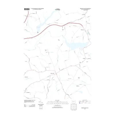
2013 Map of Brush Valley
USGS Topo · Published 2013About this map
Brush Valley serves as the central hub of this Indiana County landscape, where the agricultural flats meet the rising elevations of Strong Hill and Moose Hill. The terrain is defined by a dense network of waterways, including Two Lick Creek Reservoir in the northwest and Lake Margus to the northeast, which anchor the local drainage systems of Yellow Cr and Brush Cr. This 2013 survey illustrates a modern rural infrastructure of local connectors like Frye Cemetery Rd and Oneida Mine Rd, tracing the legacy of earlier industrial and family-held lands. Smaller settlements such as Waterman, Luciusboro, and Littletown are scattered across the quadrangle, connected by state routes that wind through the prominent peaks of Evans Hill and Pikes Peak. The map provides a clear record of 21st-century land use, balancing residential pockets with the expansive watershed of the Brush Valley region.
Find a feature on this map
85 named features on this map. Tap any name to fly to it.
Don’t see what you’re looking for? This feature index may not catch every label — zoom into the map to look around manually.
Map Details
Editions of this 2013 Brush Valley Map
This is the sole edition of this map. No revisions or reprints were ever made.
Other maps of this area

1902 · Indiana
USGS Topo · 1:62,500

1902 · Barnesboro
USGS Topo · 1:62,500

1904 · Barnesboro
USGS Topo · 1:62,500

1904 · Johnstown
USGS Topo · 1:62,500

1907 · Johnstown
USGS Topo · 1:62,500

1920 · New Florence
USGS Topo · 1:62,500

1921 · New Florence
USGS Topo · 1:48,000

1922 · New Florence
USGS Topo · 1:62,500

1943 · Punxsutawney
USGS Topo · 1:125,000

1944 · New Florence
USGS Topo · 1:62,500
Featured Places
- Brush Valley Township, PA
- Luciusboro, Center Township
- White Township, PA
- Center Township, PA
- Buffington Township, PA