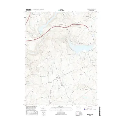
2016 Map of Brush Valley
USGS Topo · Published 2016About this map
Brush Valley and its surrounding countryside are defined by a network of creeks and ridge-top settlements in this 2016 survey. The terrain is marked by notable elevations such as Strongs Hill, Moose Hill, and Evans Hill, which overlook a complex drainage system including Yellow Creek and Brush Cr. The northern portion of the map is dominated by the Two Lick Creek Reservoir, while smaller water bodies like Lake Margus and the uniquely named Pond Number Four dot the landscape. A distinct pattern of rural life is evident through the numerous family and community burial grounds, including Brush Valley Cem, Frye Cem, and Bethel Cem. The map also traces a series of recreational paths such as the Black Hawk Trail and Damsite Trail, which wind through the hills alongside traditional routes like Chestnut Ridge Rd. Small clusters of homes at Suncliff, Rico, and Littletown illustrate the persistent settlement patterns of central Pennsylvania.
Find a feature on this map
82 named features on this map. Tap any name to fly to it.
Don’t see what you’re looking for? This feature index may not catch every label — zoom into the map to look around manually.
Map Details
Editions of this 2016 Brush Valley Map
This is the sole edition of this map. No revisions or reprints were ever made.
Other maps of this area

1902 · Indiana
USGS Topo · 1:62,500

1902 · Barnesboro
USGS Topo · 1:62,500

1904 · Barnesboro
USGS Topo · 1:62,500

1904 · Johnstown
USGS Topo · 1:62,500

1907 · Johnstown
USGS Topo · 1:62,500

1920 · New Florence
USGS Topo · 1:62,500

1921 · New Florence
USGS Topo · 1:48,000

1922 · New Florence
USGS Topo · 1:62,500

1943 · Punxsutawney
USGS Topo · 1:125,000

1944 · New Florence
USGS Topo · 1:62,500
Featured Places
- Brush Valley Township, PA
- Luciusboro, Center Township
- White Township, PA
- Center Township, PA
- Buffington Township, PA